Torres del Paine National Park
Torres del Paine National Park
181,000 hectares of granite, glaciers and lakes in Chilean Patagonia: everything you need to know about Torres del Paine National Park, its W and O circuits and how to access it.
Crowned the eighth wonder of the world in 2013, Torres del Paine National Park stands as the iconic emblem of Chilean Patagonia. With its aquamarine landscapes, granite towers and glacial lakes, this National Park remains the premier destination for hikers. Welcome to Torres del Paine, South America's most magnificent national park!
History of Torres del Paine National Park
Torres del Paine National Park was established on May 13, 1959, under the name Parque Nacional de Turismo Lago Gris (meaning "Grey Lake National Tourism Park"). It wasn't until 1970 that it received its current name.
The name originates from the three iconic granite formations it contains, known as the "Towers (Torres) del Paine". It was created to serve as a sanctuary for preserving ecosystems, landscapes and diverse species (both animal and plant life). This was done to ensure the preservation of the genetic diversity of the Paine massif (formed 12 million years ago).
In 1976, British alpinist John Gardner and two rangers, Pepe Alarcon and Oscar Guinéo, were the first to complete the "O" Circuit, which encircles the Paine massif.
UNESCO designated this park a "Biosphere Reserve" on April 28, 1978. It is one of the least polluted places on the planet. Unfortunately, the park has suffered severe fires that have devastated parts of its forests.
Torres del Paine National Park Today
In southern Chile, Torres del Paine National Park is a natural wonder. Along its numerous marked trails unfold immense snow-capped mountains, brilliant blue icebergs and glaciers, mirror-like lakes and golden pampas. These grasslands, in fact, form the natural habitat of rare endemic wildlife, such as the guanaco (the cousin of the llama).
Torres del Paine National Park remains a dream destination for hikers, ecology enthusiasts and adventure-seekers. Among the park's most emblematic natural sites are the "Torres," three granite towers located in the "Paine" massif. The "Cuernos del Paine" peaks, shaped like horns, are equally breathtaking.
Only a few park trails are accessible by vehicle. In winter, these are typically closed. The park also features some permanent lodgings and camping areas. The nearest village is Cerro Castillo, situated 50 km from the National Park. Puerto Natales, located approximately 90 km from the National Park, offers more extensive infrastructure.
Key Characteristics of Torres del Paine National Park
Nestled between the Andes cordillera and the Patagonian steppe, Torres del Paine National Park is located in the Ultima Esperanza province of Chile. Spanning 181,000 hectares, this park is a paradise for hikers and mountaineers. Cumbre Principal (3,050 m) is the highest point in the National Park.
The Torres del Paine park, measuring 100 km long by 70 km wide, is divided into several zones:
- Cerro Paine Grande and its four peaks
- Cuernos del Paine and its three peaks
- Bader valley
- Almirante Nieto mountain
- Francés valley
- Torres del Paine
- Cerro Paine
- Ascencio valley
- The three glaciers
Access to the reserve is available through three entrance gates (Laguna Amarga, Lago Sarmiento and Laguna Azul). It's an ideal location for day hikes and longer treks. The trails lead to the foot of the Torres and Cuernos del Paine.
The park is home to four distinct ecosystems: the Patagonian steppe, the Magellanic forest, the pre-Andean scrubland and the Andean desert. Because of these varied ecosystems, numerous animal and plant species have made Torres del Paine their natural habitat.
The fauna of Torres del Paine National Park is incredible. It is home to 170 insect species, over 120 bird species and 3 amphibian species. To this can be added four exotic fish species, 25 mammal species and seven reptile species.
It is the guanacos that tend to capture visitors' attention most. They are often spotted near Porteria Sarmiento. The rhea (ñandues) can be observed around Laguna Azul and the Administrative Headquarters. As for condors, they prefer to soar over the Pehoe lake station.
Along the trail leading to Lago Grey, you'll observe catitas, austral thrushes, woodpeckers, great horned owls, long-tailed meadowlarks and cometocinos. The huemul is rare to spot. Most of the time, it remains near the glaciers.
Regarding flora, this park is home to 274 different plant species. On the eastern side of the park, you'll find small isolated shrubs called Coirón, or dense thickets. Endemic forests of Lenga, Ñirre and Coigue cover the valleys and hillsides in the western part of the park.
Torres del Paine National Park: A Natural Jewel to Discover
Among the many wonders of Patagonia, Torres del Paine National Park stands apart. Its raw beauty provides a spectacular playground for kayaking, horseback riding, climbing and trekking enthusiasts. Forests, snow-capped peaks, turquoise lagoons and blue-hued glaciers comprise the essence of its landscape.
Salto Grande
Salto Grande is accessible via a 15-minute walk (650 m each way). It is an immense waterfall created by the flow of Nordernskjöld lake into Pehoé lake. The wind here blows extremely hard, so caution is necessary. From Salto Grande, head out on an easy hiking trail to the "Mirador Cuernos". This route takes approximately 1 hour (4 km). The hike culminates before the Nordernskjöld Lake, whose blue-green waters create a harmonious landscape ensemble.
Salto Chico
Salto Chico is another waterfall worth visiting. It owes its existence to the flow of Pehoé lake into the Paine River (Río Paine), which itself flows into Toro lake. The 1 km route is relatively easy and enjoyable.
Cuernos del Paine
The Cuernos are renowned throughout the National Park. The massif is easily identifiable by the color of its peaks. The contrast between the black sedimentary layer of the summits and the lighter rock below is striking. Together they resemble horns, hence the name "Cuernos". You can admire them particularly from the "Mirador del Nordenskjöld."
Toro Lake
Toro Lake, with an area of 202 km², is the park's largest body of water. On the lake's shores, you'll contemplate vegetation typical of Patagonia, such as ñires, lengas and cypresses.
Sarmiento Lake
Sarmiento Lake lies entirely within Torres del Paine National Park. Covering an area of 90 km², this intensely blue body of water was named in honor of Spanish explorer Pedro Sarmiento de Gamboa, who discovered it in 1580.
Lago Grey
To reach the "Mirador Lago Grey" viewpoint, you'll need to hike for approximately 45 minutes from the parking area. The trail begins by crossing the Avutardas River via a footbridge. You'll then traverse a forest before arriving at Grey Lake.
Continue along a trail that will lead you to the "Mirador Lago Grey". This offers breathtaking views of Grey Lake, where blue icebergs float near the end of their life. On clear days, you can see the Grey Glacier in the distance, rising majestically at the far end of the lake.
Pehoé Lake
Fed by the Río Paine, Pehoé Lake covers an area of 22 km². It sits at the very heart of Torres del Paine National Park. With its turquoise waters ringed by lush vegetation and the Cuernos del Paine as a backdrop, Pehoé Lake offers one of the park's most stunning landscapes. When the weather is clear, you can see the mountains reflected in its crystalline waters.
The Torres del Paine
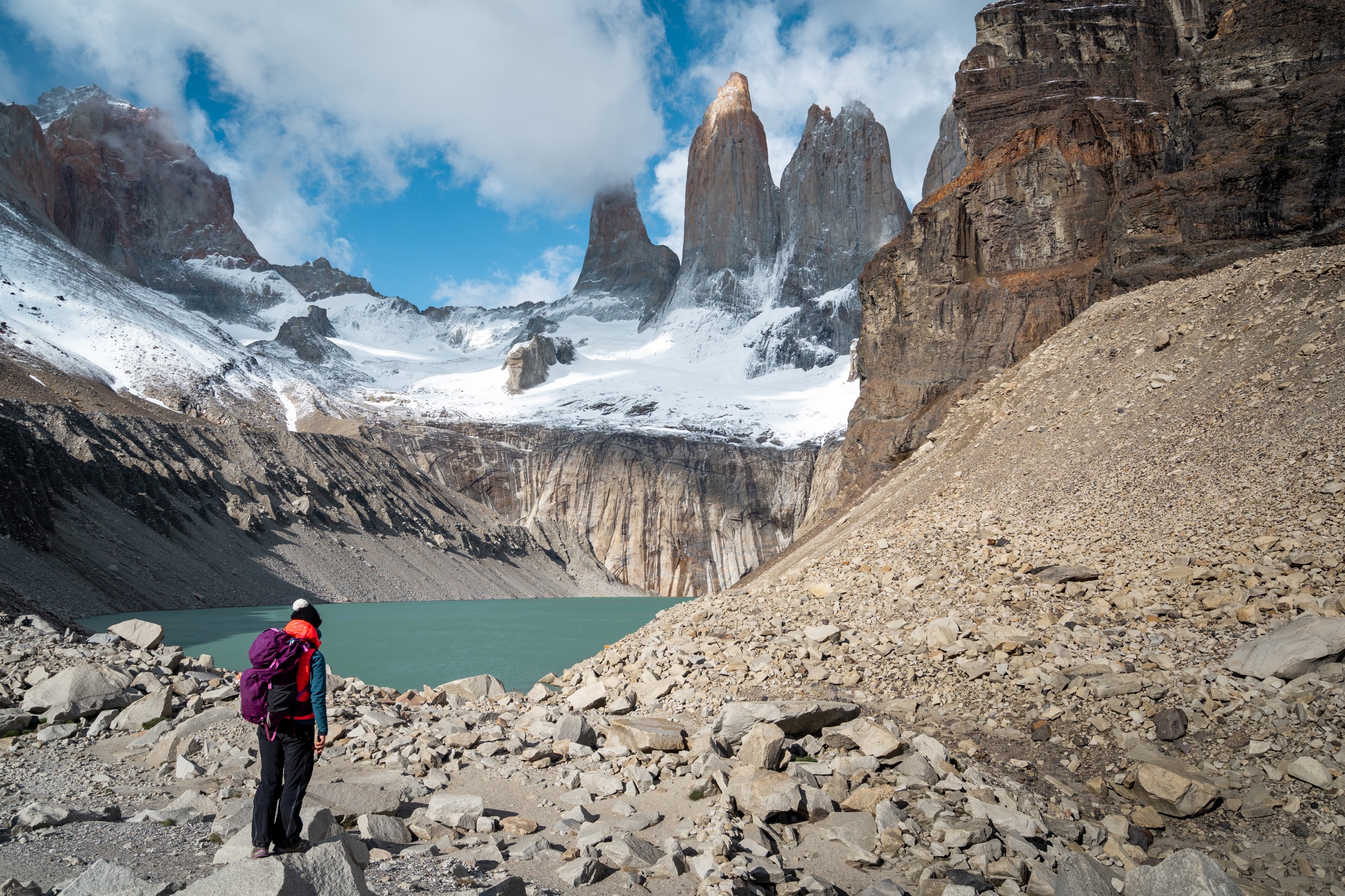
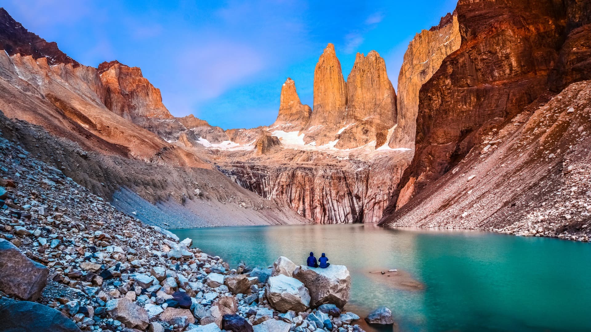
The "Torres del Paine" are the iconic mountains of the National Park. These are three granite summits located in the "Paine" massif, named Torre Norte, Torre Central and Torre Sur.
The towers rise vertically, aligned from north to south. The highest tower is Torre Sur or Torre Di Agostini (2,860 m elevation). Torre Norte or Torre Monzino reaches 2,246 m, while Torre Central rises to 2,800 m. To reach the Torres del Paine from Francés Valley, head northeast into the park.
What to Do in Torres del Paine National Park?
Depart from [Puerto Natales], located approximately 100 km from the park, to reach this magnificent site and set out hiking. The trails are perfectly marked.
The park's main itineraries:
- The "W" circuit, the shorter of the two main itineraries, is named for its "W" shape. It connects Ascencio Valley, Francés Valley and Grey Glacier Valley.
4 to 5 days of hiking are required to complete the "W" Circuit (72 km). The W Trek reaches the Torres viewpoint and ends at Grey camping, facing Grey Glacier.
If you're a novice hiker, it's best to do the W Circuit from west to east. The trek starts at Lago Pehoé and finishes at the Torres (the three granite peaks). This alternative is easier to complete since there are more descents than ascents.
- The "O Trek" is a loop itinerary around the Paine Massif (the Towers). By exploring a larger section of the national park (129 km long), this circuit is undoubtedly the most demanding. It requires between 7 and 9 days of hiking.
It follows the same route as the "W", with the added bonus of circling the Cuernos del Paine from the north. One of the highlights of this itinerary is descending John Gardner pass. Here, you'll be rewarded with a 180° view of the Grey Glacier.
Normally, this loop circuit departs from Hostería Las Torres, then circles the massif following the course of Río Paine. From there, you reach Grey Glacier before finishing on the W Circuit route.
The hike is undertaken counter-clockwise. This allows you to avoid the powerful headwinds experienced on the trail, and to reach the towers on your final day, at sunrise.
Other activities are also available at the park, such as catamaran excursions on Grey Lake and Pehoé Lake. The one on Grey Lake allows you to get closer to Grey Glacier. And if you're a keen horseback rider, this park is ideal for this activity. It's also possible to kayak between icebergs, glacier walk with crampons or simply go fishing.
The Climate in Torres del Paine National Park
The climate in the Torres del Paine park area is subpolar oceanic. Temperatures remain cool in both summer and winter. In summer (January to March), they reach a maximum of 20°C. In winter (July to September), the minimum is -2°C. Precipitation can occur throughout the year.
Weather conditions can be extremely harsh due to sudden weather changes, humidity and strong winds that frequently sweep across Patagonia. The best time to trek in the park is between October and March.
By Air
The National Park entrance is 400 km from the airports of Punta Arenas (Chile) and El Calafate (Argentina).
By Bus
Bus lines connect the park to Puerto Natales. The journey takes 3 hours to travel from Puerto Natales to the Sarmiento entrance. From El Calafate, you must pass through Puerto Natales before arriving at the park. The journey takes 5 hours.
By Boat
From Puerto Montt, cruises head toward Torres del Paine National Park once per week. The crossing takes approximately 3 days. It's the perfect opportunity to admire magnificent landscapes, such as the channels of southern Chile or fjords.
Interested in this visit?
We can include it in your personalised itinerary.