Pumalin Park
Pumalin Park
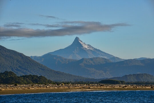
Pumalín Park, 402,392 hectares of Valdivian forests, fjords and volcanoes in northern Chilean Patagonia, accessible from Caleta Gonzalo via the Carretera Austral.
The Pumalín National Park is located in northern Patagonia, on the Chilean side. It is the largest park in South America (with a total area of 402,392 hectares).
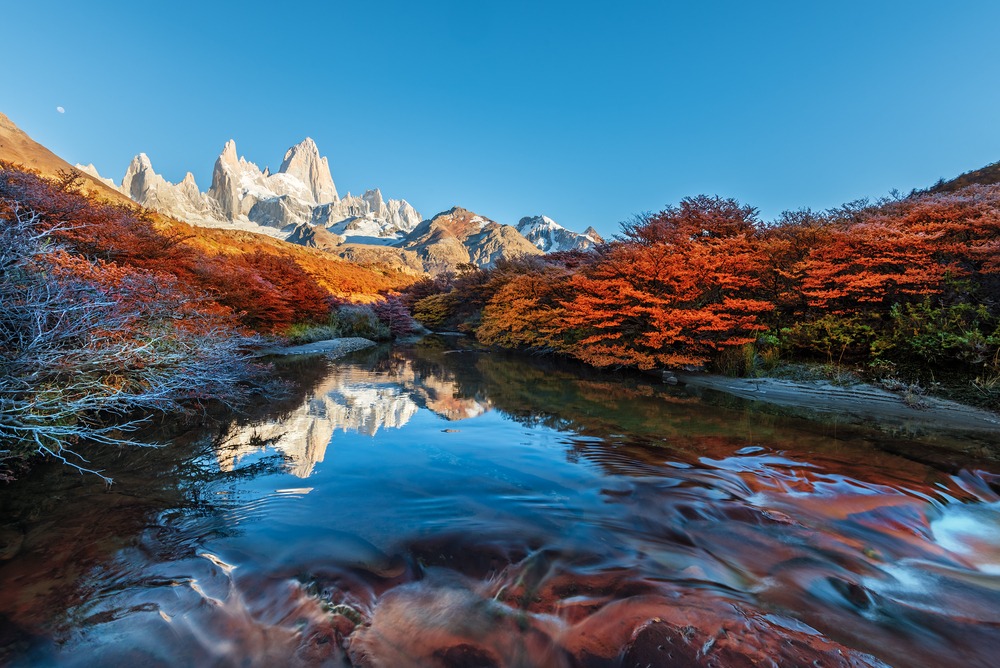
Lush forests cascading down from towering peaks and sheer granite walls plunging into the sea: such is the breathtaking landscape awaiting you at Pumalin.
A dive into the heart of this natural jewel, ideal for ecotourism and adventure.
The History of Pumalin Park
Pumalín National Park was originally a project initiated by Californian Douglas Tompkins and his partner Kris in 1991. An alpinist and Chile enthusiast, Douglas Tompkins first acquired the Reñihué farm, a vast territory scattered with abandoned plots.
He wanted to protect a primitive temperate rainforest indigenous to the region, threatened by logging. Between 1991 and 1998, his Conservation Land Trust foundation continued purchasing land in the area.
On August 19, 2005, Ricardo Lagos, then president of Chile, declared Pumalín park a Natural Sanctuary in Chile. The park was closed in 2008 during the eruption of the Chaitén volcano and reopened only in 2010. In 2018, the Tompkins Foundation donated the park to Chile.
Pumalin Park Today
Pumalín park, located in northern Chaitén region, represents one of South America's most significant and diverse conservation efforts.
Beyond the lakes, snow-capped peaks (the Andes), waterfalls and volcanoes it harbors, the park protects 25% of Chile's Valdivian Alerce forest within its boundaries. This is a temperate forest facing extinction that shelters trees over 3,000 years old.
The park boasts numerous tourist facilities, including cabins, several marked hiking trails, information centers and camping areas.
The hiking trails suit all levels and lead to waterfalls and active volcanoes, such as Michimauda.
Kayakers can paddle along the Comao and Reñihué fjords to spot dolphins, sea lions, and even whales. Experienced climbers can attempt the ascent of enormous granite walls and vast glaciers.
Overview of Pumalin National Park
Pumalin park is one of Chile's most beautiful destinations. Located at the gateway to Patagonia's fjord region, it is ringed by glacial valleys, active volcanoes and rainforests.
Only 2% of Pumalin park's total area is accessible to the public. Pumalín National Park features 12 marked trails, with 8 located in Pumalin Norte and 4 in Pumalin Sur. Hiking duration varies considerably, ranging from 30 minutes to over 10 hours.
Overall, the park is easy to explore. The scenic Carretera Austral route, running through it, serves as the starting point for various trails. This reserve is immaculately maintained and features several camping zones, restrooms, cabins and shower facilities.
Pumalin Park is best visited in January or February (the driest months of the year). The climate is extremely humid, with rainfall exceeding 6,000 mm annually.
Discovering Pumalin Park
Thanks to its diverse ecosystems, Pumalin Park is home to abundant and varied wildlife. Among mammals, you'll find mountain monkeys, culpeo foxes, coipos, colocolo cats, ferrets, pumas, huemuls, river otters and pudús.
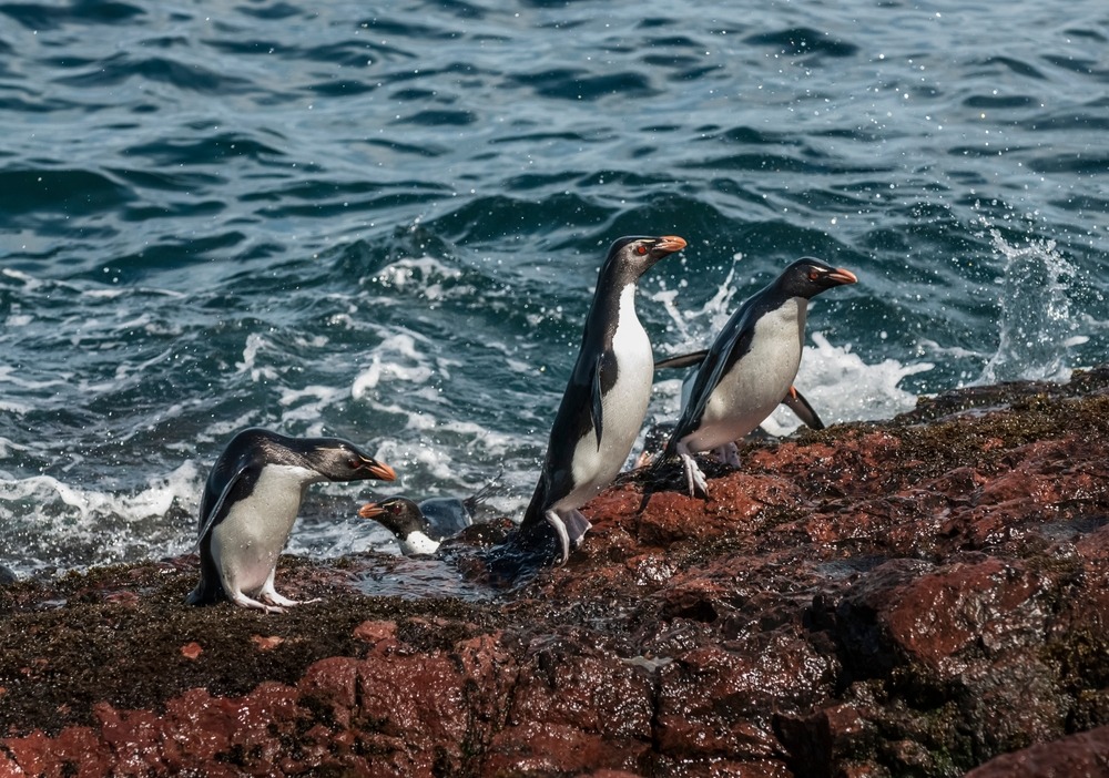
This park is also the natural habitat for 39 bird species. Among them are penguins, herons, cormorants, swans and bandurrias. Looking skyward, you may spot condors or falcons.
Pumalín park's landscape has been shaped by glaciation. It features large rock formations sculpted by ice, valleys and sandy deposits. In the park's north-western section, glacial valleys and lakes flow into the sea.
Essential Trails
Multiple hiking paths allow exploration of Pumalin park. All originate from the Carretera Austral. The trails span 80 km between the villages of Caleta Gonzalo and El Amerillo. Most are day hikes. At Caleta Gonzalo you'll find an information center, a café/restaurant, a few cabins and a camping area.
- The Alerces Trail (Patagonian Cypress) is renowned for its ancient trees. They grow remarkably slowly (one centimeter per year) and can only be found in this region of the world. The Patagonian Cypress is a protected species standing over 50 meters tall and, unfortunately, facing extinction.
- The "Hidden Waterfalls" trail is less crowded and relatively easy. It stretches 5.6 km through Valdivian forest and follows several rivers. Much of the route runs along wooden walkways and stairs, giving it particular charm. The most challenging section involves crossing a river using a rope to avoid slipping. This trail leads to three waterfalls.
- The Michinmahuida Volcano trail is another flagship route in Pumalin park. Covering 24 km (round trip), it takes approximately 8 to 10 hours. The glacier is visible from the forest. The path is well-marked and crosses several streams. After traversing a torrent, you can observe the Michinmahuida glacier.
A World of Activities
Hiking
The park offers numerous hiking opportunities leading to incredible landscapes, such as an active volcano crater or a lush rainforest. Along the way, you'll cross streams, torrents and waterfalls.
Kayaking
Embark on an unforgettable sea kayaking adventure discovering Pumalin park's fjords, in Chile's Lake District. Paddle between enormous granite walls and waterfalls cascading directly into the sea. Take the opportunity to admire southern dolphins and sea lions and explore hidden lakes.
Fjord Cruises Through Patagonia
Aboard a small traditional wooden boat, you can cruise through Pumalin Norte's fjords: Quintupeo and Cahuelmo. You'll see sheer cliffs dotted with waterfalls, Alerce forests and snow-capped peaks. It's also an opportunity to swim in the thermal waters of Cahuelmo fjord and Llancahue island.
Another cruise allows you to explore Pumalin Sur. From Fjord Comau's waters, you'll navigate to Leptepu. This is a chance to discover the Andes cordillera and a virtually untouched environment where only a few fishermen live.
By Bus and Ferry from Puerto Montt
Daily buses and ferries depart from Puerto Montt heading directly to Caleta Gonzalo or Chaitén. The journey takes 9 hours, costing CLP 14,000.
By Car or Hitchhiking from Puerto Montt
From Puerto Montt, take the Carretera Austral heading south to reach Caleta Arena. From there, take a ferry to Peluche, a short 20-minute crossing. Ferries depart every half hour. The fare is 700 CLP per vehicle.
From Peluche port, drive to the small town of Hornopiren. From Hornopiren, take another ferry to Leptepu. The journey takes approximately 5 hours. You'll then drive for about 10 minutes to Fiodo Largo. From there, you board another ferry to Caleta Gonzalo.
Interested in this visit?
We can include it in your personalised itinerary.