Land of Fire
Land of Fire
Glaciers, fjords and endless steppes: Land of Fire, an archipelago at the edge of the world, unveils its extreme landscapes between Argentina and Chile.
Located at the southern tip of the South American continent, the Land of Fire archipelago is commonly nicknamed "the end of the earth". In addition to being home to Ushuaia, the world's southernmost city, this incredible land presents windswept steppe landscapes, glittering glacial lakes and jagged peaks. A closer look at this land at world's end.
The History of Land of Fire
Originally called "Terra Australis Incognita", the archipelago later took the name "Terra del Fuego", meaning "Land of Fire". This name was given by the first European explorers venturing onto these lands, including Ferdinand Magellan (1520).
Indeed, the latter was responsible for the discovery of the Strait of Magellan. This passage was formed through the enormous glaciers that once covered the southern part of Latin America.
From their ships, European explorers saw moving fires in the darkness. In fact, these were campfires lit by Amerindians, who had lived on these lands for nearly 8,000 years. The indigenous peoples (the Selk'nam and the Yahgan) being scantily dressed, they used the fires to keep warm.
These two peoples were descendants of the Tehuelches, the first inhabitants of Land of Fire. The Yahgan were essentially nomadic hunter-gatherers, traversing the region by canoe. The Selk'nam, an indigenous group now extinct, were hunters who preferred to hunt game on solid ground.
Navigators believed Land of Fire was a continent until 1578. Sir Francis Drake then became convinced it was surrounded by water. To verify this, he sailed to the southern tip of Land of Fire.
During the first voyage of the HMS Beagle in 1830 to Land of Fire, four Amerindians were captured to be presented to the British monarchy. Of the 4 indigenous peoples, only 3 survived. They were able to return to Land of Fire aboard the Beagle with Charles Darwin.
In the nineteenth century, Europeans settled on the islands of Land of Fire nearly exterminated the native populations. Beyond numerous massacres, colonists also brought diseases (tuberculosis, smallpox and typhoid). Today, only a few rare descendants of these peoples still live in Land of Fire.
Land of Fire Today
Land of Fire is shared between Argentina and Chile, with Argentina occupying only one-third of the territory. The Strait of Magellan separates the archipelago from the rest of South America. It is an almost uninhabited land and still little developed. On its southern tip lies Horn Island, home to the legendary Cape Horn promontory.
At the end of the nineteenth century, sheep ranchers settled on Land of Fire. Even today, estancias and agricultural enterprises remain essential to local economic development.
As for fauna and flora, they are abundant and varied. Fauna consists mainly of guanacos, penguins, foxes, nutrias, beavers and various bird species. There is also exceptional marine wildlife, such as whales, seals, dolphins and walruses.
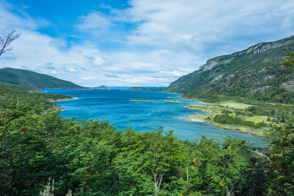
Steppes, lakes, peatlands and forests make up the landscapes of Land of Fire. In its southwestern part, beeches and wooded escarpments are dotted with myrtles and magnolias.
Ushuaia, the world's southernmost city and the regional capital of Land of Fire, is now an industrial city. Inhabitants live mainly from fishing and tourism. Indeed, during summer, large sailing vessels navigate along the Argentine and Chilean channels.
Characteristics of Tierra del Fuego
Land of Fire is shared between Chile and Argentina. The Argentine part is attached to the province of Land of Fire, Antarctica and the South Atlantic Islands.
The Chilean part is divided between the province of Tierra del Fuego (in the north) and Chilean Antarctica (in the south). Both parts are located in the region of Magallanes and Chilean Antarctica.
The archipelago consists of thousands of islands and islets, most of which are highly fragmented and home to numerous fjords. With a total area of approximately 68,000 km², it stretches nearly 400 km from north to south and 700 km from east to west.
The Great Island, the largest in Land of Fire, measures 48,100 km². This island is mountainous on its western side. The Darwin Cordillera has Mount Darwin at 2,488 meters as its highest point. The island is also graced by a plain along its Atlantic facing.
The two largest islands west of Tierra del Fuego are Santa Inés and Desolation Island. The Beagle Channel separates the Hoste and Navarino islands from the Great Island. Even further south of Navarino Island lies a small archipelago. It is composed of the Wollaston, L'Hermite and Horn islands.
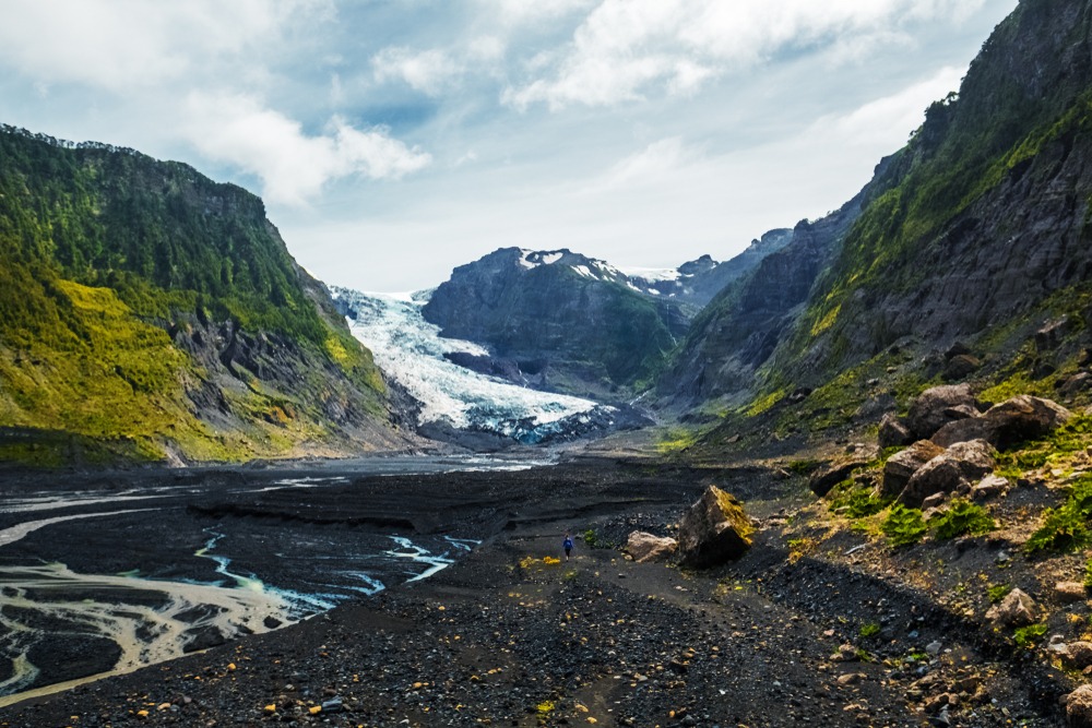
Almost all islands in this Magellan archipelago are formed of barren, black, vertical and wild rocks. The mountains, reaching between 1,000 and 2,000 meters in altitude, are covered with perpetual snow, especially above 1,500 meters. Their peaks are jagged and sharp. On the flanks of the summits, you can see glaciers and dark-leafed forests. The glaciers flow directly into the sea.
Tierra del Fuego, a Jewel of Argentine Patagonia to Explore
Tierra del Fuego is a land of extremes, where landscapes emerge from another world. Here, islands rub shoulders with eternal ice, fjords and blue icebergs drift along peaceful, green waters. It is also a land where you hear the crashing of breaking ice and find picturesque fishing ports filled with Cape Horn vessels.
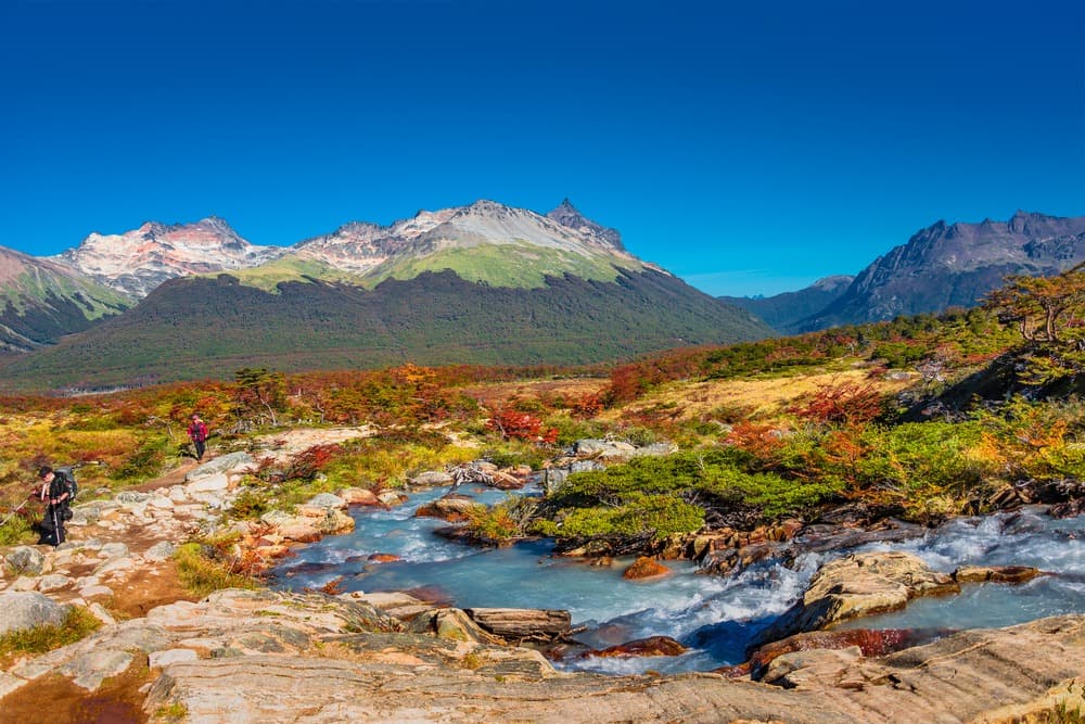
It is through hiking that this wild immensity is best discovered. With its slate-colored waters, marshes and stretches of windswept steppes, Land of Fire is an ideal place to enjoy nature. The main island, the Great Island of Land of Fire, is home to the Tierra del Fuego National Park. Located in the southwestern part of the Land of Fire province, this park protects a subantarctic forest and its rich ecosystem, including lenga, a tree that can reach 30 meters in height.
The sparsely populated Chilean side is home to isolated ranches nestled amid endless stretches of forests, lakes, blue glaciers and mountains. On the Argentine side, meanwhile, activity is in full swing. In Ushuaia, you can try your hand at a dog sledding adventure, race down the ski slopes or explore the Beagle Channel, which takes you to Isla Navarino.
Beyond Garibaldi Pass, Route 3 leads to Ushuaia, a name that resonates like a promise of adventure. This mythical city is nestled in the heart of Land of Fire. Highly touristy, it stretches along a majestic bay bathed by the icy waters of the Beagle Channel and ringed by the mountains of the Darwin Cordillera.
Ushuaia is often used as a base to explore the surrounding waterways and summits. Set off on a hike into the Tierra Mayor valley, towards Martial Glacier or along the coast. The trails are well-marked.
Climate
Land of Fire is divided into two climatic regions:
The southern part (Darwin Cordillera and Mount Sarmiento) is rather mountainous, humid and cloudy.
In the north, the climate is dry and windy.
In Rio Grande, to the north, the average temperature is 10°C. In Ushuaia, to the south, it is 5°C.
Generally speaking, Land of Fire has rather cool to cold weather year-round due to its southern latitudes. Temperatures average 0 to 5°C during the austral winter and 5 to 10°C during the austral summer. Winds blow quite violently and rainfall is nearly daily.
In spring, temperatures are mild. Autumn is also a good season to visit Land of Fire, because of the reddish colors displayed by the Ñirres, a species of deciduous tree.
You can visit Land of Fire at any time of year. However, depending on the type of visit, you should choose the right season. For example, for a winter stay (skiing), it is better to go from June to September. For classic tourism or hiking, it is better to go during the warmest months, which are generally January and February.
By Plane
Opt for domestic flights departing from Ezeiza International Airport in Buenos Aires (Argentina).
From Buenos Aires, you can make a stopover in El Calafate (Argentina). From there, take another flight to reach the city of Ushuaia (Land of Fire).
You can also take a direct flight from Buenos Aires to Ushuaia (Land of Fire). The journey takes approximately 3 hours, for a distance of 3,000 km.
By Bus
By road, you will need to cross the Chilean border. From there, take a ferry to cross the Strait of Magellan. The ferry is only available at two locations: Punta Arenas (approximately 3 hours of travel time) and Punta Delgada (approximately 20 minutes of travel time).
By Boat
Another way to reach Argentine Land of Fire is to take a cruise, departing from Argentina or Chile. The boat generally docks in Ushuaia.
Car rental is the best way to get around the archipelago, given the vast distances. Nevertheless, a network of minibuses is available in Ushuaia.
Want to discover this destination?
Our local advisors design your tailor-made trip.