Cape Horn
Cape Horn
Cape Horn, the mythical promontory at the edge of Tierra del Fuego: maritime history, fjords, southern wildlife and advice for a cruise from Ushuaia or Punta Arenas.
The legendary Cape Horn was long the primary maritime passage between Asia and Europe. Mysterious and notoriously treacherous, Cape Horn consists of an immense cliff facing south, perched on Horn Island. Set your course for this iconic waypoint of great ocean voyages, steeped in maritime history.
History of Cape Horn
Cape Horn was allegedly first discovered in 1525 by Francisco Hoces, a Spanish sailor. According to his account, Cape Horn was an obstacle he encountered while attempting to navigate the Strait of Magellan. He was forced to alter his course southward to navigate around it.
In 1578, English corsair Francis Drake, compelled to divert south by a storm after crossing the Strait of Magellan, also encountered Cape Horn. He would lend his name to the passage dividing South America from Antarctica.
Cape Horn was named "Cabo de Hornos" by the Spanish and "Drake Passage" by English-speaking powers. But for reasons of state, this passage was kept as a "classified secret" by the British Admiralty, until the arrival of the Dutch.
The Dutch, tired of the monopoly imposed by the East India Company, decided to outfit two ships. At this time, the East India Company held complete control of the Strait of Magellan. The expeditions were financed by Jacob Le Maire and commanded by Captain Willem Cornelisz Schouten.
The Concorde and the Hoorn thus departed from Texel on June 14, 1615 to find a new passage, other than the Strait of Magellan. While the Hoorn disappeared in a fire off the coast of Patagonia, the Concorde expedition was crowned with success.
History tells us that the Concorde passed a cape formed by two pointed and extremely high mountains on January 31, 1616. This cape represented the ultimate tip of Tierra del Fuego. Willem Cornelisz Schouten decided to name it "Kaap Hoorn," after his city of origin.
From the 18th to the 20th century, Cape Horn was considered one of the busiest merchant routes in the world. Ships were laden with commercial goods such as wool, gold, and seeds. Cape Horn also facilitated connections to New York and San Francisco during the Gold Rush.
Its growth continued until 1914, the date of the opening of the Panama Canal. It remained one of the world's most traversed commercial routes until the area was nicknamed the "graveyard of sailors." Navigation conditions were often extreme, with dangerous waters, violent winds, and strong currents. Over 400 years, more than 76 wrecks are said to have sunk in the troubled waters of Cape Horn.
The first small sailing vessel to truly navigate Cape Horn was a 13-meter yacht named Saoirse, as part of a world circumnavigation (1923 to 1925). It was maneuvered by Irish writer and sailor Conor O Brien, accompanied by three friends. The weather was favorable at the time.
Cape Horn Today
Cape Horn is an almost-vertical promontory 425 meters high. It marks the tumultuous meeting of the Pacific and Atlantic Oceans, as well as the northern boundary of Drake Passage.
It is located at the southern tip of Horn Island in the Tierra del Fuego archipelago, in its Chilean portion. This point is generally considered to be the southernmost point of South America. Vegetation is abundant thanks to frequent precipitation.
Today, few ships attempt to venture there, except for sports navigators planning a world circumnavigation. Consequently, Cape Horn has become a powerful symbol of world sailing races.
Several major races follow the route of ancient merchant routes that passed through Horn Island. The Volvo Ocean Race (circumnavigation with stopovers) and the Vendée Globe (nonstop), two solo races held every 4 years, are typically organized around this legendary point.
General Location of Cape Horn
Cape Horn is considered to be the southernmost point of South America and of the Great Capes. Landing on Horn Island is only possible if weather conditions permit.
This legendary location remains a challenge for navigators, fascinated by its tumultuous character. The sea is wild and encounters with icebergs are frequent. Before your astonished eyes can form immense swells, ceaseless storms, rogue waves, or powerful Antarctic circumpolar currents.
Viewed from a ship, Cape Horn appears as a terrifying rock. In reality, it rises from a small island (Horn) measuring 6 kilometers long and 2 kilometers wide. It is also important to distinguish between the "true" Cape Horn (Horn Island) and the "false" Cape Horn. The latter is a rock located on Hoste, an island neighboring Horn.
Cape Horn has been classified as a UNESCO World Biosphere Reserve since 2005. Wandering through the Cape Horn National Park, one discovers endemic species of southern continental Patagonia.
Among flora, you can find shrubs such as Romerillo and Mala Negra with small white flowers. The flowers of Magallanes Orchid, Frutilla de Diablo (fruit with a bitter taste), and Nothofagus trees are also present.
Regarding fauna, the species living there are quite intriguing. Notable sightings include the steamer duck, royal cormorant, whale, Commerson's dolphin, Gentoo penguin, humpback orca, and Patagonian toothy fish.
Cape Horn, an Essential Patagonia Destination
It is by cruise that one reaches the mythical Cape Horn, the formidable promontory that both inspires and fascinates. This cliff, swept continuously by winds, promises an exhilarating crossing of one of the last pristine places on Earth. Indeed, Cape Horn is inhabited only by the lighthouse keeper and his family.
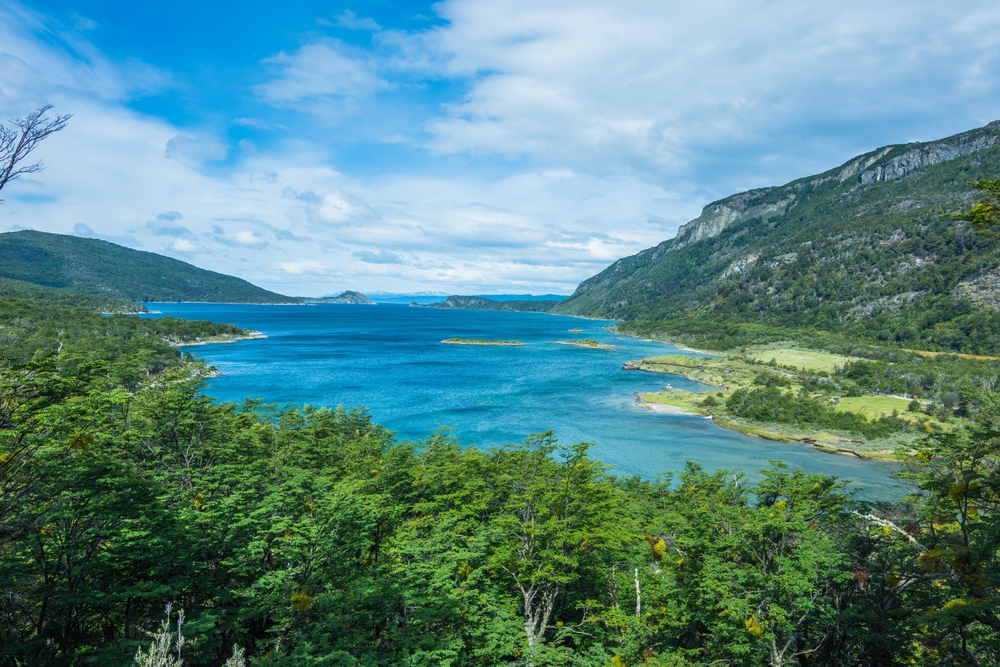
The landscape consists essentially of deep fjords, ancient glaciers, channels, reefs, and shoals. Should weather conditions be favorable, your ship will likely circumnavigate the island before continuing its journey. During your voyage, you will discover a chapel, a red and white lighthouse (the world's southernmost) and a Memorial.
The Memorial, represented by a large albatross statue, was erected in honor of sailors who perished during the crossing. For a better profile view of the rock, climb to the Memorial's viewing balcony.
The Climate
On Cape Horn, it is extremely cold, due to its location at a southern latitude. Its average temperature ranges between 5 and 2°C, with a range of 14°C in summer and −2°C in winter. Precipitation varies between 93.7 mm in October and 137.4 mm in March.
Winds reach speeds of 30 km/h and are generally accompanied by gusts exceeding 100 km/h. It is because of violent winds and powerful currents that navigation is particularly difficult. This is also why it is nicknamed the "Cape of Storms."
Regarding the best season to visit Cape Horn, it falls between October and March. As throughout the Southern Hemisphere, spring begins at the end of September through early April. During this period, not only is navigation in the best conditions, but also trees and shrubs are in bloom.
By Boat
Cruises calling at Cape Horn are few and short in duration, ranging from 4 to 5 days. Departures are typically from Ushuaia (in Argentina) or Punta Arenas (in Chile). The cruise ships available offer a maximum capacity of 210 passengers.
For experienced sailors, you can reach it by sailing vessel, which will navigate the Patagonian channels. Plan for at least 10 days of navigation at sea. Boarding and disembarking typically occur in Ushuaia.
Want to discover this destination?
Our local advisors design your tailor-made trip.